3D images and 3D models are in our everyday life, whether that’s on Facebook, or through applications like Google Earth.
The use of this technology is ever more accessible, affordable, and useful in developing an asset management strategy and bringing our buildings to life.
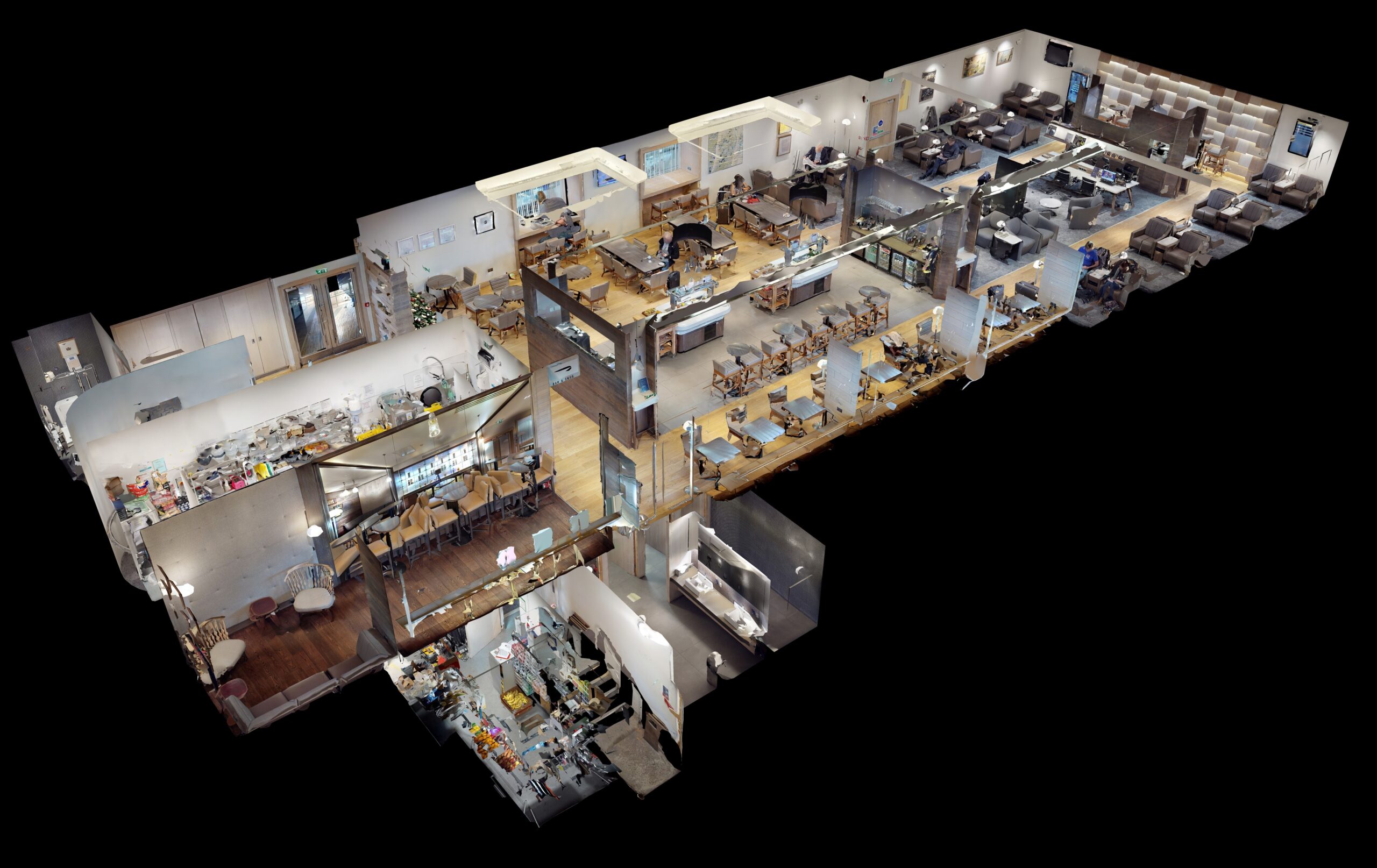
Point cloud surveys, 3D scans, and imaging are similar in that they recreate a space or object in a virtual model or a photographic output.
These scans are created by using scanners or cameras which can be floor mounted or mounted on a drone. The scans capture thousands of points and images a second and these are then stitched together to provide the final output for the user.
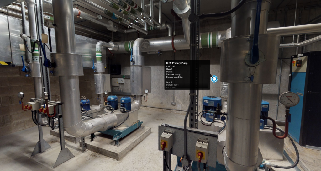
The images and models can be amended to visualise scenarios. For example, to visualise a fit-out where they can be appended with notes, links to documents, drawings, and certificates.
Walking through a space from your desktop and accessing information at the tap of a mouse brings your estate to life.
Historically surveys and inspections took several days and the information was provided in a flat form, such as a narrative report or excel file. The scanning approach and associated technology reduce time, reduce impacts on occupants, and speed up the entire process.
Facilities and property managers using these 3D reality environments are finding them to be a vital part of their asset management strategy, ensuring reliable information can be viewed and updated on all key assets and spaces in their buildings, covering HVAC, electrical, and safety systems.
This allows users to see these buildings in new and innovative ways, providing a detailed and accurate view of how their space is configured, see where improvements can be made and how they can improve productivity. Importantly this helps them increase the ROI, reduce costs, and save time.
Some of the benefits of using 3D scanning services include –
- Capture dimensional data to document structure and asset equipment
- Eliminate hundreds of documents needed to locate and keep track of asset and maintenance data
- Reduce the time taken to create and deliver floor plans
- Locate relevant information on specific assets in a single place, and remove human dependence
- Improve collaboration between dispersed teams, with the models being accessible online.
- Allow new employees to familiarize themselves or carryout learning in a virtual environment.
- Educate employees and staff on complex areas, especially hard to reach or potentially dangerous areas.
- Create complete schematic floor plans, plan emergency routes and response strategies.
- Take accurate measurements of your space, structure or assets to support refurbishment or replacement projects.
- Create scenarios and bring refurbishment or replacement projects to life by lining into REVIT files.