
Drones are a fantastic way to get cameras in hard-to-reach places. A standard drone survey of a building produces from 50 to 1000 detailed, high-resolution images; but what do you then do with all that data?
1000 images can be overwhelming and makes analysis and reporting a complicated, long and tiresome process. ELIAS makes the process more efficient, sustainable and delivers clear outcomes for your whole team.
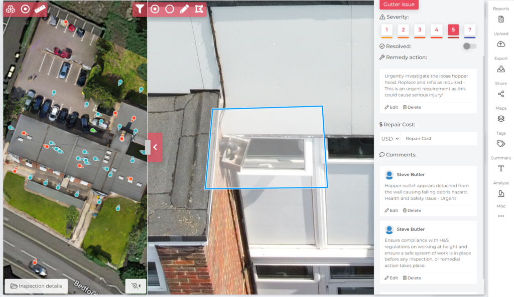
ELIAS UAV is our proprietary data management module used for aerial inspections of sites and buildings. Images are displayed as ‘dots’ on a map giving the analyst vital information about where the drone was positioned when it took the image and the direction the camera was pointing.
Images are stored securely, and because the platform is 100% cloud-based, we can give our customers direct access to inspections in a single click. Access can be provided to broad client stakeholder groups, anywhere in the world. User profiles are granted controlled access rights, however typically a user can see inspections, add comments, or analyze the inspection themselves.
Drone surveys are uploaded to ELIAS UAV and can be thoroughly analysed by one of our expert in-house building surveyors or engineers.
Annotations are rated by severity and are clearly visible when you open the inspection
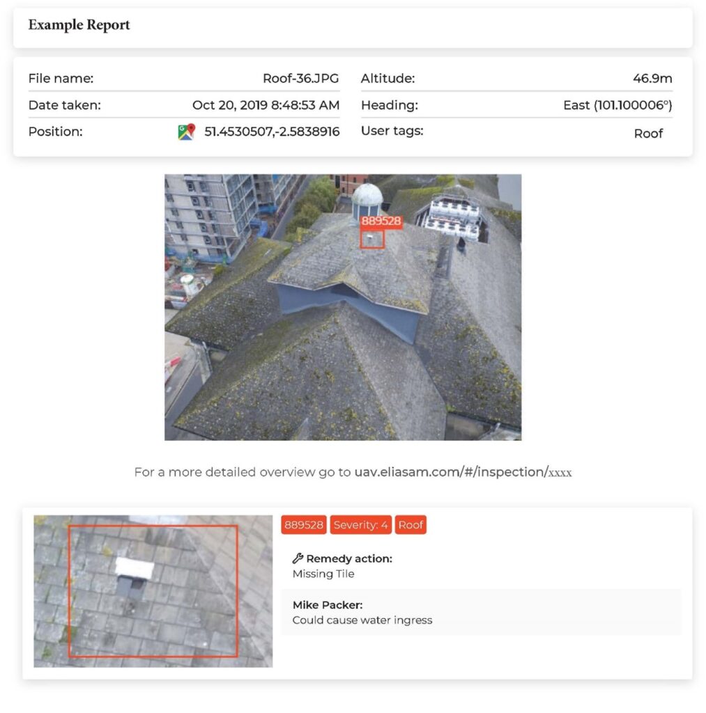
The annotations are loaded into a simple, customisable report. All reports contain an overview map of the inspection, with fault locations, as well as fault description, images, comments, and a link to the specific Google Maps location for the maintenance team.
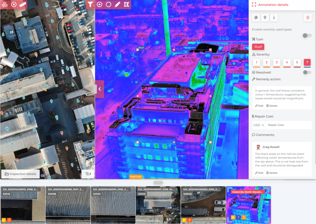
ELIAS UAV can also host thermal imagery. Annotations made by our thermography experts give valuable insights into the continuity of insulation, thermal bridging, air leakage and moisture detection on buildings.
For more information on drone surveys and ELIAS UAV please contact us.