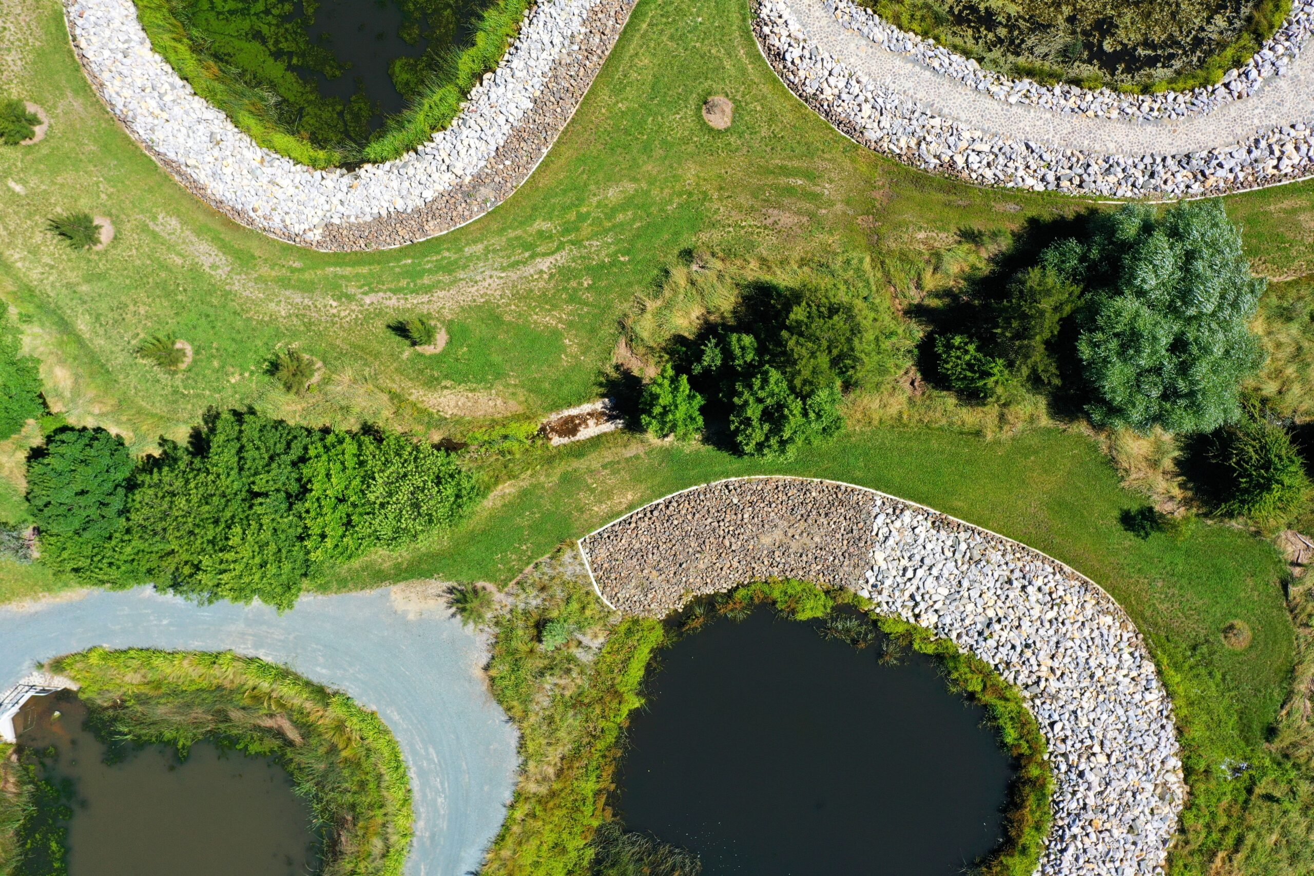
3D modeling with drones or UAVs
The demand for high-quality aerial data capture from drones or UAVs is growing fast. The technology removes the guesswork when it comes to judging a range of data. Having a clear, accurate photograph or 3D model of your project, complete with measurements, is advantageous in terms of decision-making, improves communication and the level of understanding, and gives you the best visual data available, helping you to make decisions based on fact and not theory. This will improve your asset management strategy from beginning to end.
The phenomenal rise in drone usage has led to the development of ever more sophisticated software, among which is 3D mapping software.
1/ Photogrammetry
Mapping with drones is done using a technique called photogrammetry. Photogrammetry is the science of making measurements from photographs. The output of this is normally a map, measurement, or 3D model of a real-world object or scene. Many of the maps we use today are created using photogrammetry and images taken from aircraft.
Mapping with drones is very similar to this, the main difference being the low altitude a UAV can fly, therefore capturing higher-quality images.
2/ Capturing the data with a drone
When we use drones to capture images, our X5 camera is mounted to the bottom of our DJI Inspire 1 and is usually pointed vertically down to the ground. Multiple overlapping photos of the ground below are captured as the aircraft flies autonomously along a flight path that we specify beforehand. This ensures we don’t miss anything, and enough image overlap is achieved.
3/ Processing the images
This is the smart bit, if it was possible to do this manually the process could take years of painstakingly stitching and adjusting the images, so they fit together and give a true orthographic view. Fortunately, there are now computers to do that for us!
Our ELIAS software easily enables us to put together a comprehensive survey of land, buildings, and infrastructure and presents it in a variety of easy-to-manage formats, focusing on faults and areas for attention, whilst still providing information in the context of a complete view. The best feature is the ability to take accurate measurements of length, area, and volume straight from the maps.
Need Drone Mapping Services?
Our field technology services can be stand-alone, supporting individual clients and projects or they can be part of a broader survey solution.
UAVs have the ability to fly close to buildings and into awkward positions, where other means of access may not be safe or cost-effective.
Point cloud scans allow us to render and connect a 3D space model, connect and overlay over asset data, render into Revit AutoCad models and create high-resolution floor plans. We have permission from the Civil Aviation Authority (CAA) to operate commercially in the UK and are fully insured for your peace of mind.